Study: Why troposphere warming differs between models and satellite data
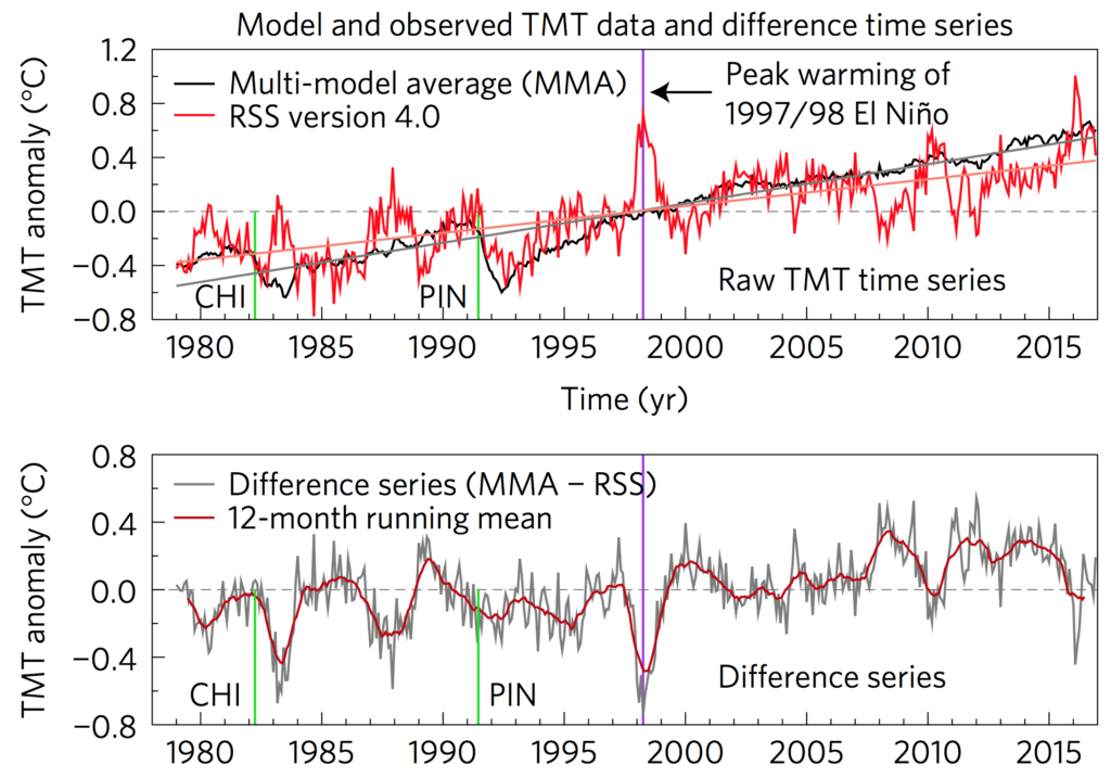
The most common measure of global temperature rise is here on the Earth’s surface, but scientists also gather data on how temperatures in the atmosphere high above us are changing.Of particular interest is the troposphere – the lowest layer of the atmosphere where almost all of our weather occurs. To track temperatures, scientists use satellites, which have been providing data since they were first launched in the late 1970s.Since around the start of the 21st century, the tropospheric warming recorded by satellites has been slower than the rate projected by climate models. In a new study, published in Nature Geoscience, researchers find that these differences are outside the range of what we would expect from natural variability.Instead, they say the differences could be down to recent changes in greenhouse gas emissions, solar output, volcanic eruptions and air pollution that weren’t anticipated in the assumptions made by climate modellers.Overall, the study suggests that while tropospheric warming has not accelerated to the extent that models have predicted in recent years, there’s little evidence that it has slowed down.§ Temperatures from satellites
historical temperature datamicrowave sounding unitsdecrease the temperaturein satellite observationsJournal of Climate§ Correcting errors in the data
only lastthat changesorbits decayupgraded versionUniversity of Alabama, HuntsvilleRemote Sensing Systems“In general, I think that the surface datasets are likely to be more accurate than the satellite datasets. The between-research spreads are much larger than for the surface data, suggesting larger structural uncertainty.”
§ Comparisons with climate models
Article information
Santer, B. D. et al. (2017) Causes of differences in model and satellite tropospheric warming rates, Nature Geoscience, doi:10.1038/ngeo2973