Guest post: Using satellites to track the retreat of Antarctica’s glaciers
Dr Hannes Konrad was formerly a research fellow in the School of Earth and Environment at the University of Leeds and now works at the Alfred Wegener Institute for Polar and Marine Research in Germany.The long history of the Antarctic Ice Sheet is one of ups and downs. Over millions of years it has responded to ever changing ocean and air temperatures and snowfall as its glaciers have retreated and advanced.Unlike the long-gone ice sheets that covered large parts of North America and Europe, Antarctica still holds huge volumes of ice even in today’s warm conditions. Its ice also forms by far the largest reservoir of fresh water on the planet – enough to raise global sea levels by about 60 metres if it were to melt.In a new study, my colleagues and I provide the most complete assessment of Antarctica’s outer glaciers to date, showing that between 2010 and 2016 they lost an area of ice equivalent to the size of Greater London.§ A natural frontier of the Antarctic Ice Sheet
ice shelvesArchimedes§ Thousands of years of retreat
around 12,000 years agoEarth observations from satellites§ Grounding lines today
Nature GeoscienceCryoSat-2 satellite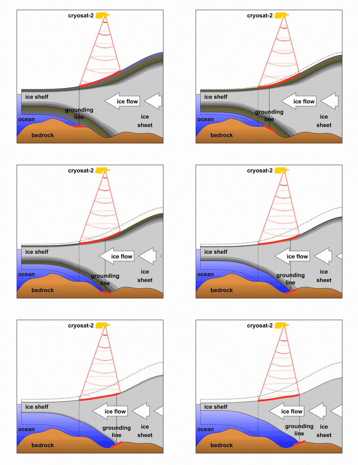
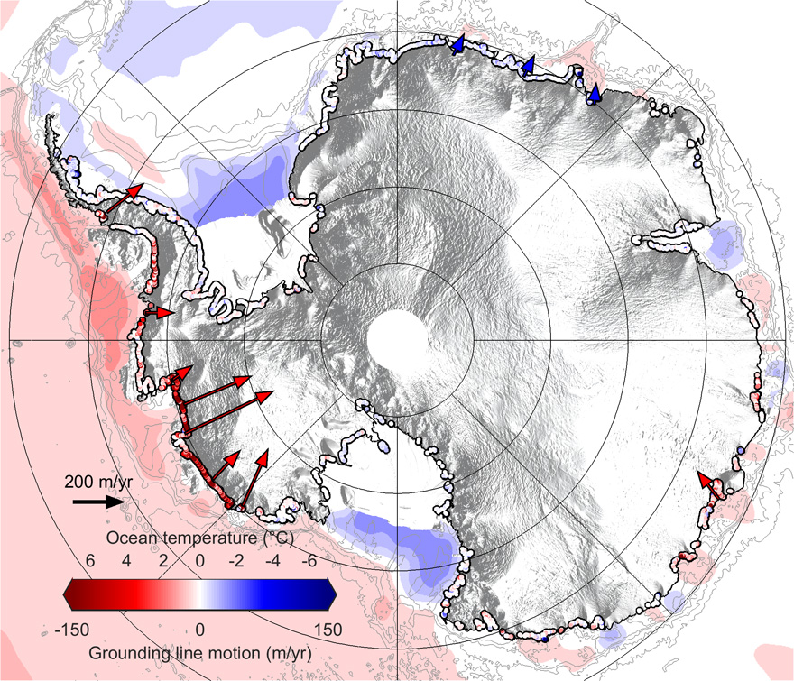
§ Warm ocean water gnawing at the ice
Oceanographic studiesArticle information
Konrad, H. et al. (2018) Net retreat of Antarctic glacier grounding lines, Nature Geoscience, doi:10.1038/s41561-018-0082-z